 |
|||||
|
It's Free! |
|||||
|
|||||
|
It's Free! |
|||||
 |
||||||
| By Randy Putt Photos: Joe Ison |
||||||
|
This was the second year of the Overland Challenge Series held in the Ozark National Forest. The following is from the official event website:
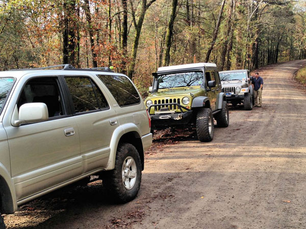
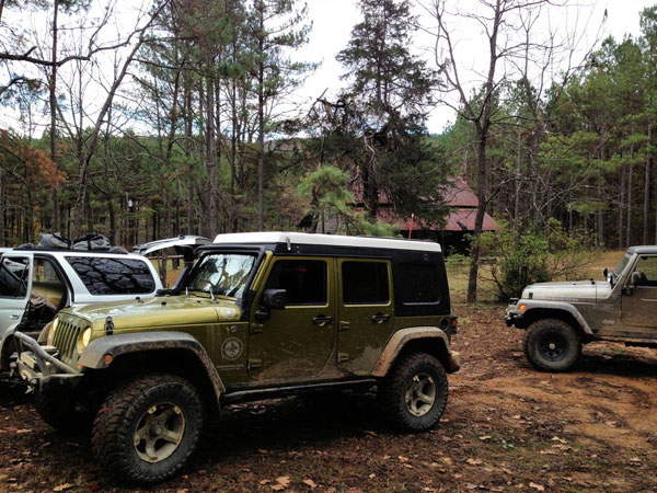
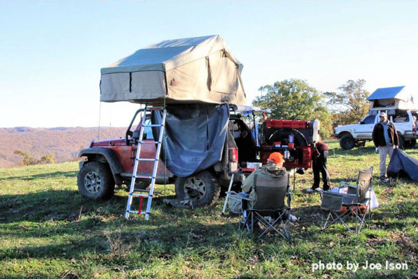
"The National Forest envelops most of the northwest section quadrant of Arkansas. To the North, you have the Buffalo River - our nation's first National River - and Mark Twain National Forest. To the South, lie the Arkansas River Valley, the Ouachita National Forest and Hot Springs National Park. The Western side of the National Forest is bordered by the Boston Mountains and several state parks. The Eastern side will lead you to Wooly Hollow State Park and eventually the Mississippi River Basin (after lots of farm land!). The Ozarks have a rich history, apparent with a stop at any rural cemetery or homestead. " Teams consisted of two or three vehicles with no more than six people total. All vehicles had to be street legal, have operating 4 wheel drive, front and rear mounted recovery points, and a full size spare. It was also recommended that vehicles have at least 31" tires, extended breather tubes, and limb risers. In addition each team had to have at least one working winch, a snatch block, a tree strap and a recovery strap. Since this was a three day trip, participants had to provide their own camping gear, food, and drinks. Five gallons of extra fuel was also recommended as gas can be scarce. Our team, The Ozark Navigators, had competed in two previous challenges where we won the first event and were disqualified for our second event due to a misunderstanding about the required checkpoints. We had three vehicles for this event, Brad, from West Monroe, LA was driving a 2005 Jeep Rubicon, James, from Southern Missouri, was driving a 1999 Toyota 4Runner, and I was driving a 2008 Jeep Wrangler Unlimited.
We arrived at the required drivers meeting held at Lake Dardanelle State Park, at 7pm Thursday evening, where we signed the standard personal injury waiver, received the coordinates for the five required checkpoints and the ten optional checkpoints of which each team had to choose at least five to make a total of ten checkpoints. The team that was successful in completing ten checkpoints while covering the least distance would be awarded the coveted honor of first place. As the drivers meeting began, so did the rain and by the time meeting was over, it had become very windy with driving rain. Our team decided to find a dry spot to plot our route for the event, iHop was the perfect spot since they are open all night. After two hours of plotting the coordinates for each of the five required checkpoints and all ten of the optional checkpoints it was time to decide which five of the optional checkpoints, in combination with the five required checkpoints would most likely give us the least mileage to the finish line. After much discussion we had our route and returned to the state park where we crawled into our sleeping bags about midnight only to be up and on our way to the starting line by 7:30am. Each team had to arrive at the starting checkpoint between 7 and 9 am Friday morning where event staff recorded each vehicles starting mileage, answered any last minute questions, and sent you on your way.
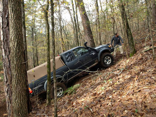
Each optional checkpoint had an associated percentage from .5% to 4% depending on the difficulty of the trail required to get there. The percentage points for each team would be totaled at the finish line and the team mileage would be reduced by the percentage accumulated by the team. Our first optional checkpoint gave us a 3.0% reduction. The good news is the rain had stopped and there was no dusty trails to deal with but the rain also made some trails muddy in spots and would impact some of the water crossings that would be required to complete our planned route. As we started our chosen route, we encountered seven staff vehicles that happened to choose the same trail as we had. All was good until we got to a steep hill climb that had some ledges about half way up that were made more difficult with the rain the night before. Our team ended up behind the staff vehicles and several were having a difficult time negotiating the slick obstacle. Five of the seven vehicles had to be winched up the obstacle before we could try our luck. Of course by this time it was rutted and slick! Two of our three vehicles we able to get over the obstacle without help but we did have to winch one. By the time we got off this first trail we were at least an hour behind schedule and had to pick up the pace to try to make up some time. With the previous days heavy rain we encountered two water crossings that were 3-4 foot deep! I was the only one with a snorkel in our group and choose to cross at the deepest part while my team mates choose the safer route to the other side. We all made it through with no problems.
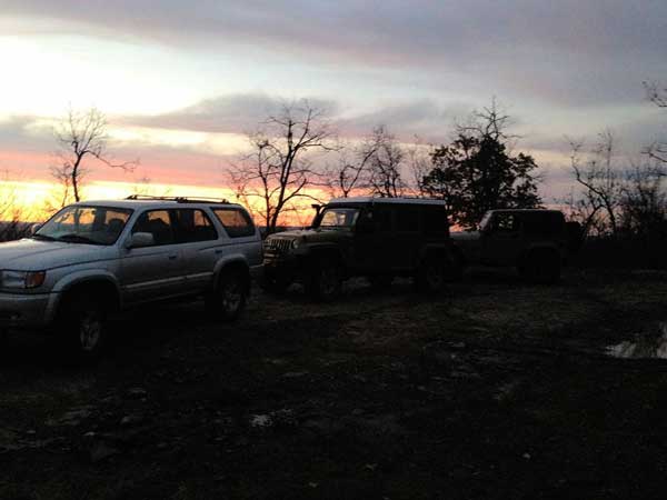
As it turned out, we were about an hour late to our last checkpoint of the day. This checkpoint is known as Pilot Knob, which is a knob that sits about 2300 feet above sea level and affords some breathtaking views. Unfortunately, by the time we got there, the sun had all but disappeared on the horizon and this is the only picture we got. It was time to find a place to camp for the night so we headed back down the mountain in search for camping spot. By the time we found a spot, we had driven about sixty miles, completed two of the five required checkpoints, and four of the five optional checkpoints we had chosen.
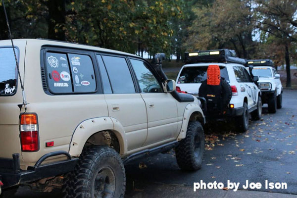
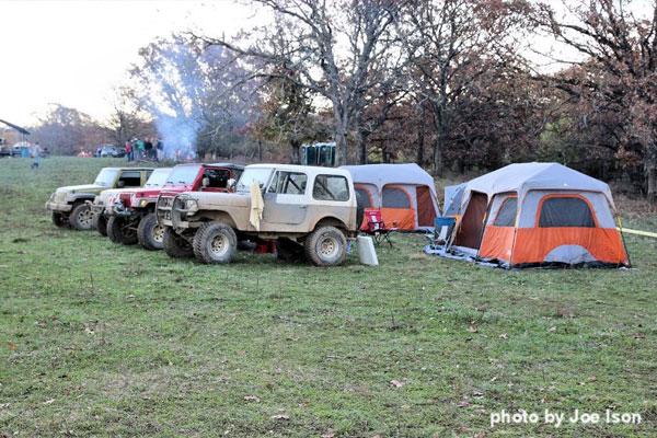
As we set up camp for the night one of the other teams drove up and asked if they could share our campsite. Everyone had a good time sharing their experiences of the day as we wound down from the day's journey. The second day would be an easier day for our team as our route would be less challenging for the most part and not as time constrained. We were up and back on the road by 7:30am and headed toward our next checkpoint which was the old Union Schoolhouse built in 1929 after the previous schoolhouse built in 1886 had burned down. Our next stop was the old homestead. Part of this homestead was built during the Civil War. A gentleman by the name of Bub bought the property for the timber but kept the old homestead open for those that happen to wonder by on the dirt road. If you're lucky, Bub will be there taking care of the place. Bub's always willing to tell some stories of the history of this area and give visitors a tour of the old homestead, barn, and well.
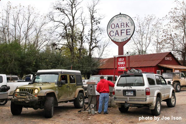
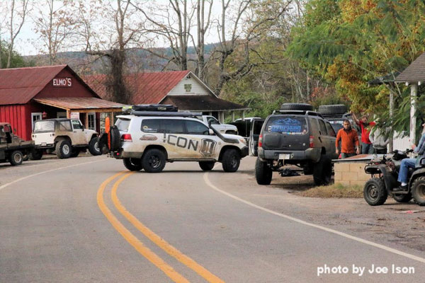
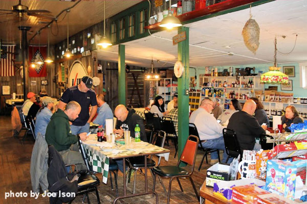
Unfortunately Bub wasn't there this trip, but it's just as well, because we didn't have time to stay and chat as we had to be at the Oark General Store, our next checkpoint, before 10am. We were making good time when we drove up on another team that was pulled to the side of the trail. We stopped only to find out the Tacoma one of them was driving, had broke the passenger side front axle assembly. We pulled over to see if we could lend a hand. Two bolts had come loose and the axle collapsed causing the tire to blow. After further inspection it was discovered that two of the four bolts required were sheared off and the other two had worked their way out along the road. Thank goodness the owner had brought some spare parts and was able to get the axle assembly back together. Once they had everything under control, we decided to continue on in hopes of making the next checkpoint on time. As we pulled up to the Oark General Store many of the challenge participants were there, filling up their vehicles outside and their tummy inside. This store has been in operation since 1890, the oldest such place in Arkansas. Inside, everyone was having breakfast and swapping stories of the challenges they had encountered thus far. Some were planning out the day's route mile by mile. We finished breakfast and were back on our way. We still had a lot of miles to cover to get to the finish line by dark.
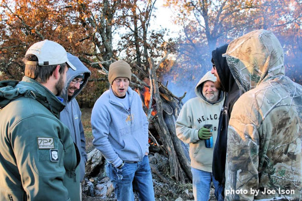
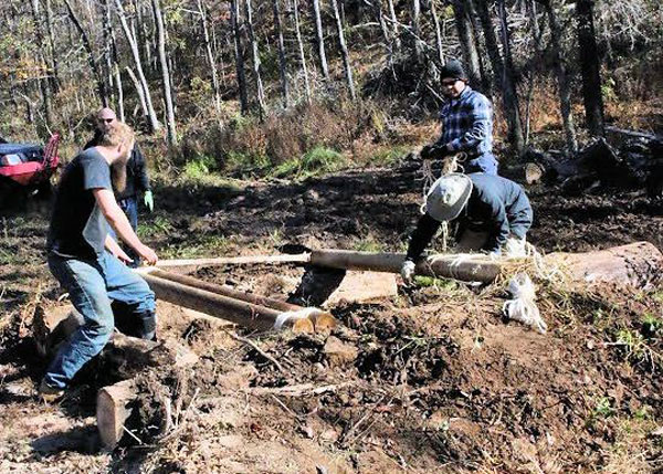
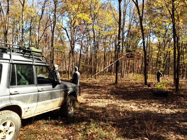
We made it to our last optional trail and then on to Shore's Lake, the last required checkpoint before the finish line. We arrived at Shore's Lake by 2pm and even though we had all our required checkpoints there was one more optional checkpoint that looked like we might be able to do without adding any additional mileage to our trip as it was in the general direction we needed to travel to get to the finish line. It also had a 2.5% mileage reduction which indicated it might be a little more challenging than the other trails we had encountered thus far. There was some question as to whether the closest trail that would take us to the challenge trail was even open though. The decision was made to at least go to the trail head and find out. As it turned out, the trail we wanted to take was in fact gated and by the time we would get to the alternate route we were concerned that we would be late to the finish line and it would probably add more mileage than the 2.5% reduction provided by completing the trail. At this point we decidedto play it safe and back track the 1.2 miles to our original route and head for the finish line. Little did we know that this 2.4 miles would come back to haunt us. We pulled up to the finish line about 3:30pm on Saturday afternoon. The finish line was on private property just West of Winslow, AR. Our official mileage was 153 and had accumulated reduction points of 8%. We made our way down the trail to the camping area for the night. As more teams arrived the stories abounded! Everyone enjoyed the pork BBQ dinner provided and then it was off to the campfire as the temperature had dropped into the 40's and the bonfire was the place to be. Tomorrow would bring a hearty breakfast followed by the awards ceremony then for those that wanted to stay, there were several optional challenges including a teeter-totter, a winch challenge, blind driver course, bridge building, and one last challenge trail.
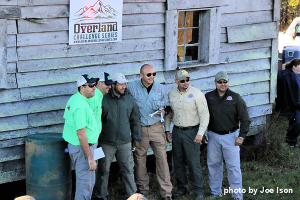
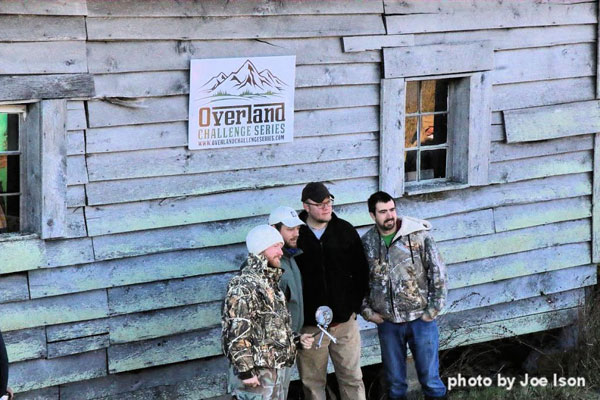
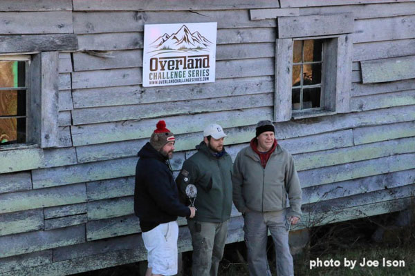
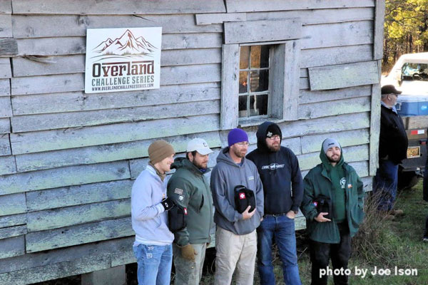
Daylight came early and everyone was up making their coffee and warming by the fire while breakfast was prepared. After a good breakfast, it was time to find out if our route and resulting mileage and discount percentage would land us in the winner's circle. As everyone gathered around the first place winners were announced, it would be OGE4x4 hailing from Venezuela by way of Miami Florida with a total mileage of 151.2 and an accumulated 11.75% reduction for an adjusted mileage of 135.3. The second place team was the Mudbloods with a total mileage of 148.57 and an accumulated 5.75% reduction for an adjusted mileage of 140.49. Our team, The Ozark Navigators took third place with a total mileage of 153 and an accumulated 8% reduction for an adjusted mileage of 141.6! Not bad for a field of 13 teams, and yes we all wished we had those 2.4 miles back! There was also a Camaraderie Award that went to the team that helped out other teams the most during the event. This award went to the Mud Crawlers. Here is the way everyone finished. FIRST PLACE TEAM: OGE4x4
SECOND PLACE: Mudbloods
THIRD PLACE: Ozark Navigators
Camaraderie Award: Mud Crawlers
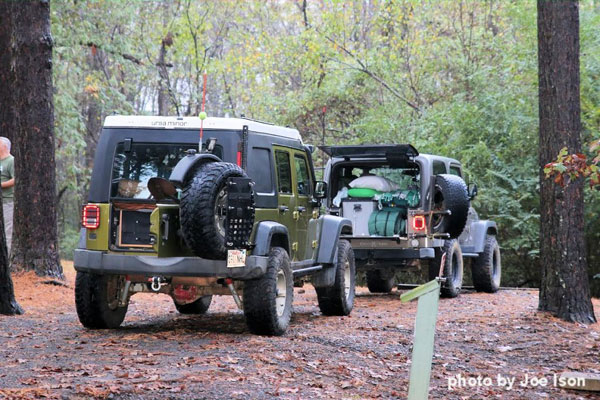
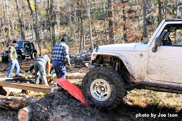
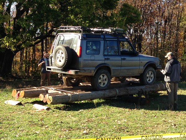
One of our team members had to leave before the awards, so the two of us that stayed decided to try some of the optional challenges. Here are a few pictures of those challenges.
It was another great event and I want to thank Jayston Landon for creating it, and the rest of the staff members that helped put this event together, including Violet Westrick, Rick and Nickie England, Tod Dudley, Tony Natali, Les and Lesia Griffin, Kole Wade, Joe Ison, Nathan and Jami Travis, Spencer Robinson, and Will Cody. My hope is that this event will continue to grow and would become one of the premier events of this type in the country. Until we ride again, |
||||||
Comments